· 4 min read
Releasing Underland View: Web Visualisation of the Subsurface
3D mining models? View and share faster.
What is Underland View?
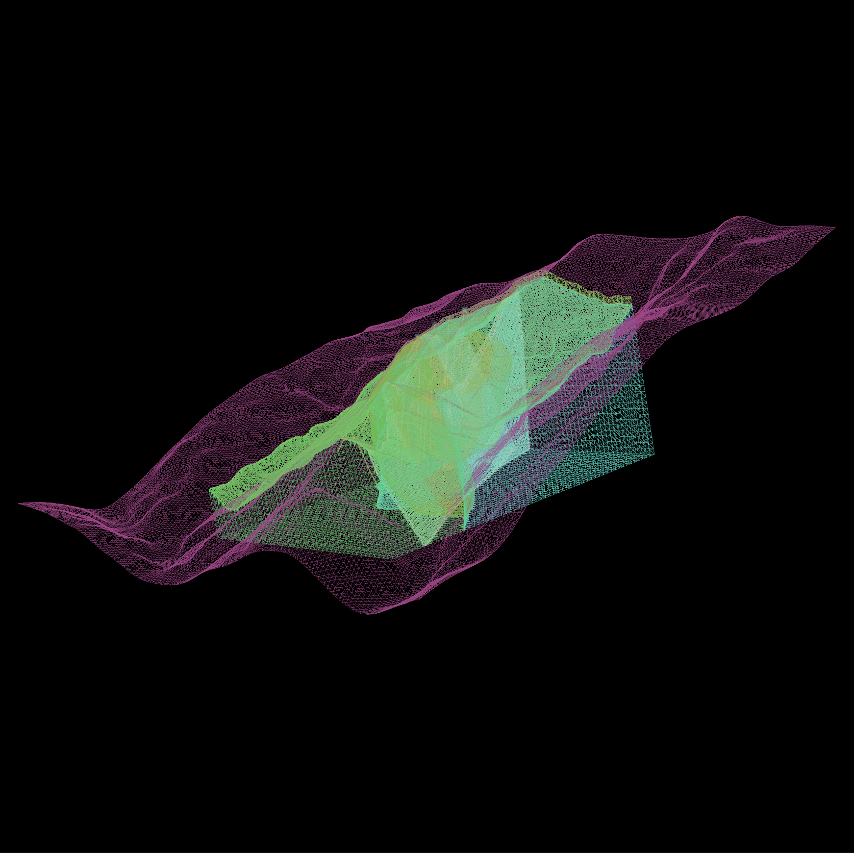
Underland View provides a secure, web-based platform for viewing and sharing 3D resource project data with a simple upload and URL-share, facilitating immediate collaboration without the need for specialised software or high-end computing hardware. The initial release, Underland View v1.0, focuses on providing the visualisation of 3D mining data and models utilising the industry-standard Open Mining Format (OMF) and GeoH5 (partially supported). Our objective is to facilitate cloud-based workflows and stakeholder engagement for 3D mining data, moving beyond the limitations of local workstations and stock exchange PDF reports.
Who is Underland View for?
Underland View is engineered for a diverse range of professionals and database companies within the resources industry who require the ability to share, view, and collaborate on 3D resource models. This includes:
- Geologists
- Mining Engineers
- Mining database companies
- Consultants
- Project Managers
- Investors
- Large organisations with complex resource modelling requirements
- Local community stakeholders
How does Underland View work?
Streamline your workflow into three straightforward steps:
- Export & Upload: Export your Open Mining Format (OMF) or GeoH5 (partially supported) from your existing mining software and upload the 3D mining model through our secure web interface.
- Configure Layers: Toggle which layers are visible to focus your narrative in settings.
- Visualise & Share: Launch visualisation, then copy the unique URL and send it to your stakeholders.
Key Capabilities of Underland View v1.0
- High-Performance Visualisation: Explore subsurface project information directly in your web browser. Our AWS High-Performance Computing (HPC) backend ensures a fluid, interactive 3D experience, removing the dependency on specialised software or powerful local workstations.
- Instant Collaboration: Securely share your 3D model and mining data with stakeholders instantly via a unique URL link.
- Total Data Control: Maintain complete data sovereignty with secure hosting on AWS. Enterprise clients have the option of a fully self-hosted solution.
- Broad Compatibility: Underland View integrates with your existing software workflows. Export your project data with ease from leading packages such as Leapfrog, Deswik, Mira Geoscience, Maptek Vulcan, Micromine, GEOVIA, and, Datamine.
- Global Reach, Low Latency: By leveraging AWS’s global infrastructure, we serve your models from data centres located near your stakeholders, ensuring optimal load times worldwide.
- API Access: Integrate Underland View into your workflows with API access for programmatic control, available on our Enterprise plan.
- Dedicated Support: Our team is available to assist with integration, deployment, and scaling to meet your operational requirements.
Frequently Asked Questions
Here are some common questions about Underland View. If you cannot find the information you require, please contact our support team.
Data Security & Hosting
Where is my data stored? We prioritise your data sovereignty. Your data is never stored on our own servers. All data is hosted on Amazon Web Services (AWS), the world’s leading cloud platform. This provides robust security, reliability, and allows your data to be stored in specific geographic regions to meet compliance needs.
Who has access to my subsurface project data? You maintain full control. Only users you explicitly grant access to can view or interact with your subsurface models via secure, time-limited links and role-based access controls.
Enterprise & Integration
Can we host our own data? Yes. For organisations with strict data residency or internal governance requirements, our Enterprise plan offers a self-hosted option. You can deploy the Underland View platform within your own cloud environment, giving you complete control.
Do you provide an API? Yes, our Enterprise plan includes API access. The API allows you to programmatically upload models, manage projects, and embed the 3D viewer directly into your company’s internal applications, websites, or data platforms.
Processing & Performance
How long will it take for my subsurface model to be processed? Thanks to our AWS High-Performance Computing (HPC) backend, most subsurface models are ready within a few minutes. However, processing time can occasionally take longer depending on the size and complexity of your data (up to 1TB) and current platform demand. We’re constantly optimising our processing pipeline for speed.
Do you support any file formats besides OMF and GeoH5? Yes! While OMF and GeoH5 (partially supported) are our primary format, we are actively developing support for others. We plan to add support for VTK, GOCAD, CSV, and OBJ files in the future. If you have a specific format need, please ask!
Getting Started
How do I get started? Visit Underland View to create a free account and explore the platform. To unlock sharing, API access, and collaboration features, choose a Professional, Team, or Enterprise plan. For enterprise inquiries, please contact us.
How can I provide feedback? We value your feedback! Please use the contact us form to share your thoughts, suggestions, and any issues you encounter. Your input is crucial as we continue to develop Underland View.